Unlock Caribbean opportunities with the CAMDI and Barbados data
28 February 2022The CAMDI and Barbados surveys target the highly prospective Southeastern Caribbean Region, tying several producing areas, and deep-water wells (including Sandy Lane). CAMDI is the most modern dataset in the region, best suited for the current 2022 Trinidad and Tobago and upcoming Barbados licensing rounds.
Competitive rates are available on the high-quality pre-stack time, pre-stack depth, gravity and magnetic datasets.
Please contact us today to find out more:
Robert Sorley
robert.sorley@geoexmcg.com
+1 (281) 744 0854
About CAMDI and Barbados Products
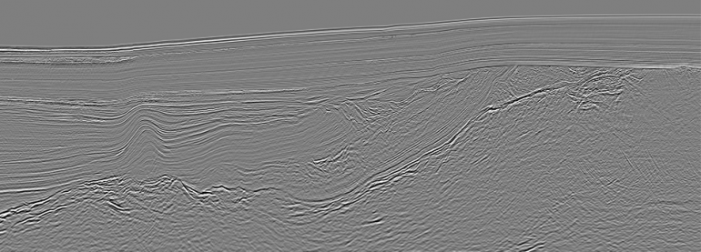
The Caribbean Atlantic Margin Deep Imaging and Barbados surveys are designed to assist oil companies to better understand the regional tectonic framework of the various basins along the Southeastern Caribbean and Western Atlantic margin of Northeast South America. The CAMDI survey includes a Detailed Grid off Trinidad and Tobago and Grenada, and when integrated with the Barbados survey they provide more detail, tying the producing areas to the underexplored deeper part of the Tobago Trough and Barbados.
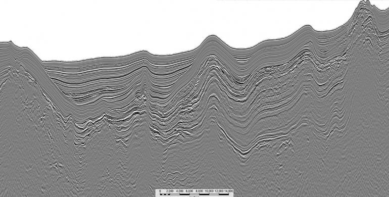
The Tobago Trough is an underexplored area flanked by oil and gas production to the East and South in Barbados and Trinidad and Tobago. Its prospectivity was recently underpinned by a new gas discovery offshore Grenada. Seismic interpretation of these surveys shows a thick sedimentary succession in the Tobago Trough. The presence of a mature La Luna oil-prone source rock in the Trough seems likely.
The Caribbean Atlantic Margin Deep Imaging and Barbados survey tie the Sandy Lane well in Barbados. In addition, CAMDI ties to several deeper wells in Trinidad and Tobago.
CAMDI
CAMDI Survey Acquisition Parameters
The Caribbean Atlantic Margin Deep Imaging survey was acquired using a 37.5-meter shotpoint interval and Continuous recording 18-second record length. The survey covers Barbados, Trinidad and Tobago, Grenada and St. Vincent, and includes a Detailed Grid covering Trinidad and Tobago and Grenada.
Concept | Parameter |
Acquisition system | Sercel Seal System |
Shotpoint interval | 37.5 m |
Sample rate | 2 ms |
Cable type | Sentinel Solid Streamer |
Number of receivers | 960 |
Receiver interval | 12.5 m |
Cable length | 12 km |
Cable depth | 12 m (+/-1 m) |
Fold | 160 |
Recording time | 18 s (Continuous Recording) |
Recording mode | Continuous Recording |
Receiver type | Solid: Sercel Flexible Hydrophone |
Source type | G-GUN |
Source volume | 5,020 in2 |
Number of sources | 1 |
Pressure | 2,000 psi |
Source depth | 7.5 (+/- 1 m) |
Filter | 3 HZ analogic-Filter antialias linear |
Data format | 8058 IEE |
X min | 150 m |
X max | 12,200 m |
Gravity | Yes |
Magnetic | Yes |
Barbados
Barbados Survey Acquisition Parameters
The Barbados survey was acquired in 2012/2013 and reprocessed in 2015. The survey was acquired using a 37.5-meter shotpoint interval and Continuous recording 13.5-second record length, over a 14 x 14 km and 7 x 7 km prospect grid. The survey covers the Barbados Trough, the Tobago Basin and crosses the Barbados Ridge.
Concept | Parameter |
Acquisition mode | 2D Single streamer / Single source |
Recording system | Sercel SEAL 24-bit Digital / ION DigiStreamer |
Shot interval | 37.5 |
Source volume | 5300 cubic inch |
Source pressure | 2000 psi |
Source depth | 7 m |
Streamer length | 10050 / 10000 m active length |
Group length | 12.5 m |
Streamer depth | 8 m (nominal) |
Nominal fold coverage | 134 |
Near trace offset (COS-CNG) | 150 / 135 m (nominal) |
Record length | 13.5 sec |
Record format | SEG-D 3590 IEEE / SEG-D 3592 IEEE, Rev 2.1 |
Sampling rate | 2 ms |
Low cut filter (analog, system inherent) | 3 Hz @ 6 db/oct |
Low cut filter (digital) | Off |
Combined LC filter (analog + digital) | 3 Hz |
High cut filter | 200Hz @ 370 db/oct / 214Hz @ 574 db/oct |
Shooting direction | Various° |


